
It is not often that I start a trail run at the civilized hour of 8h00 on a Saturday. But we were waiting for the tide to be out.
I was lucky enough to be invited on this route by Mark Preen. This ranks as one of the best adventure trails in Cape Town.
‘But that was easy’
Could quite easily be the response of one of the other runners in our group. Not so fast! The first time I did this trail which is a mere 10km it took us the whole day! Yes as in a 8h whole day! Ask around and you will hear stories of epics, getting lost, scary scrambles, groups being benighted, rescues, and people being washed out to sea – never to be seen again.
I am not kidding. This is serious!
However on Saturday we were lucky with very calm seas and Spring low tide! Richard planned well and we even had an hour to go before the lowest tide – just in case.
Route direction
I have done this route in both directions and I prefer the anti clockwise. Either option is doable. I just prefer it. Here I will describe the clockwise direction though as this is the way we did it last.
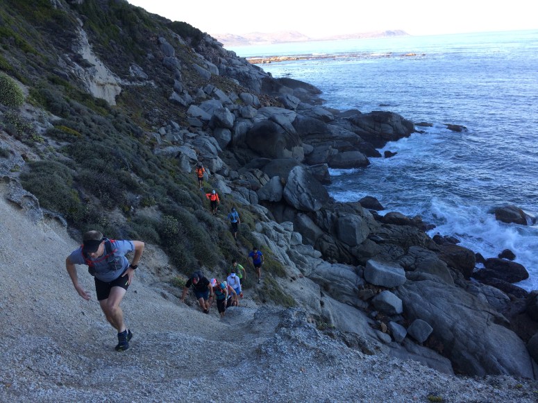
A good start spot is Mariner’s Wharf. Run through the harbour towards the Sentinel. This is along tarmac. You will pass underneath the Hangberg suburb. You will quickly emerge onto some level single track under the cliffs of the Sentinel and towards Seal Island. This section is very reminiscent of the first bit of the Otter trail.
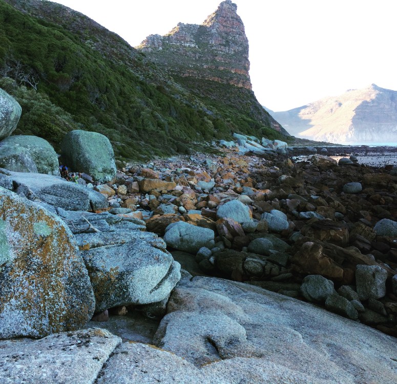
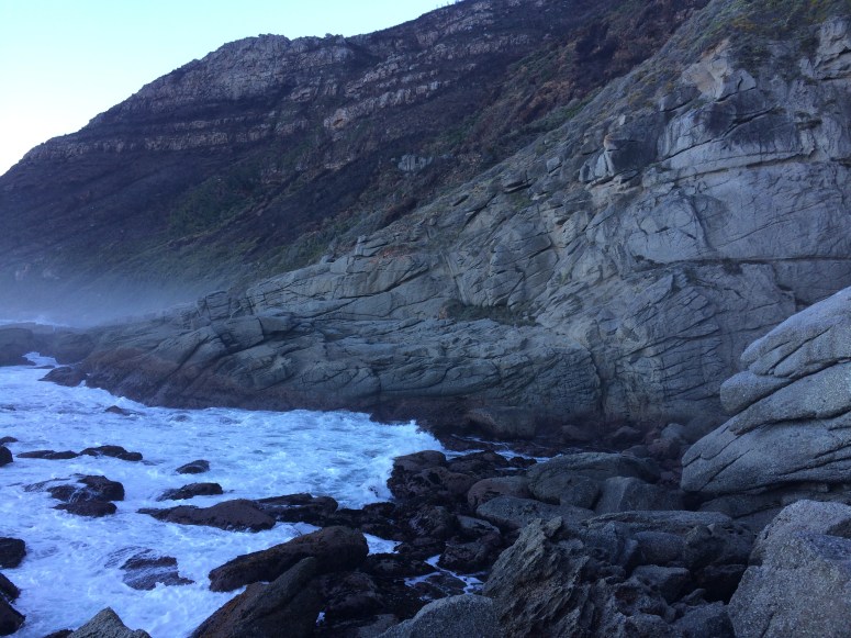
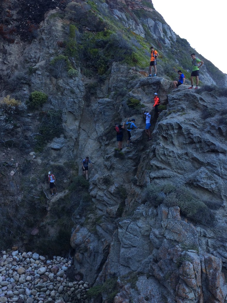
Once you turn the corner things get a bit more serious in that you need to think about route choice. Staying low and close to sea level is best until forced up. It initially seems like you need to traverse over a steep gully with a path visible on the steep far slope. Don’t try this but rather drop into the gully and back down to sea level.

A few sections of scrambles over damp, slippery rocks follow. Going is slow as one needs to take care.

This is a great great friction testing lab for shoes as adhesion to a variety of surfaces is tested to the max. Some you walk, others you need a bit more upward momentum…
There are often several options available and you don’t always need to scramble.
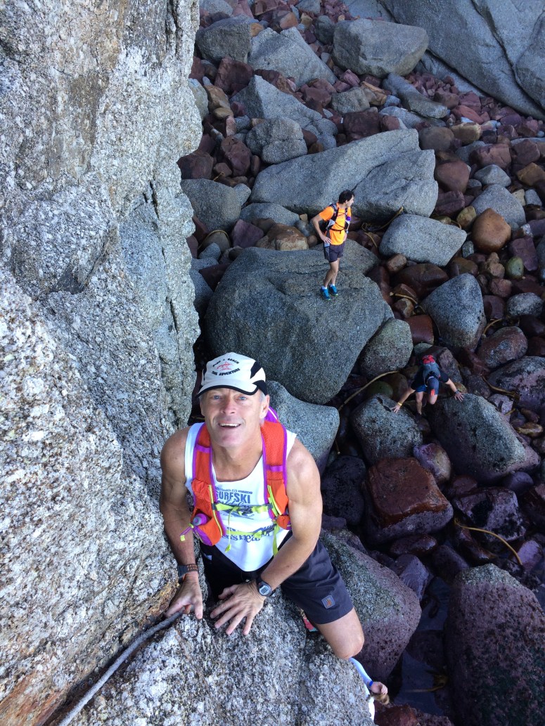
However at some point you will be faced with this sight. Spot the tatty rope. It ascends the black crack onto the platform above the water. The first step is the hardest. I would encourage you to take a rope – in case.
There is a little section of easier going after which you will face another gully. Once again don’t be tempted to traverse above but rather drop down past the little granite blob onto the floor of the gully and out the other (less steep) side.
Eventually you will do a slow rising traverse on a fair path. This pops you onto the slabs above the Bos 400 which went down in 1994. This is the same bay where the SS Maori is also located. From here it is a fairly straightforward navigational exercise across the burnt sandy slope to the blockhouse at the end of Rocket Road. Find your way to the dunes above Sandy Bay. From here you are pretty much on tarmac back to the start and some welcome fish and chips at Fish on the Rocks.
I can not stress this enough. This is a serious route which requires respect. You will need to go in a group with enough scrambling experience and somebody who knows the route. Also carry a couple of mobile phones in waterproof pouches.
You will struggle to complete this in under two hours. But a fairly competent group should be done in under four. Come prepared for a truly special adventure.

Maybe one day I’ll get there